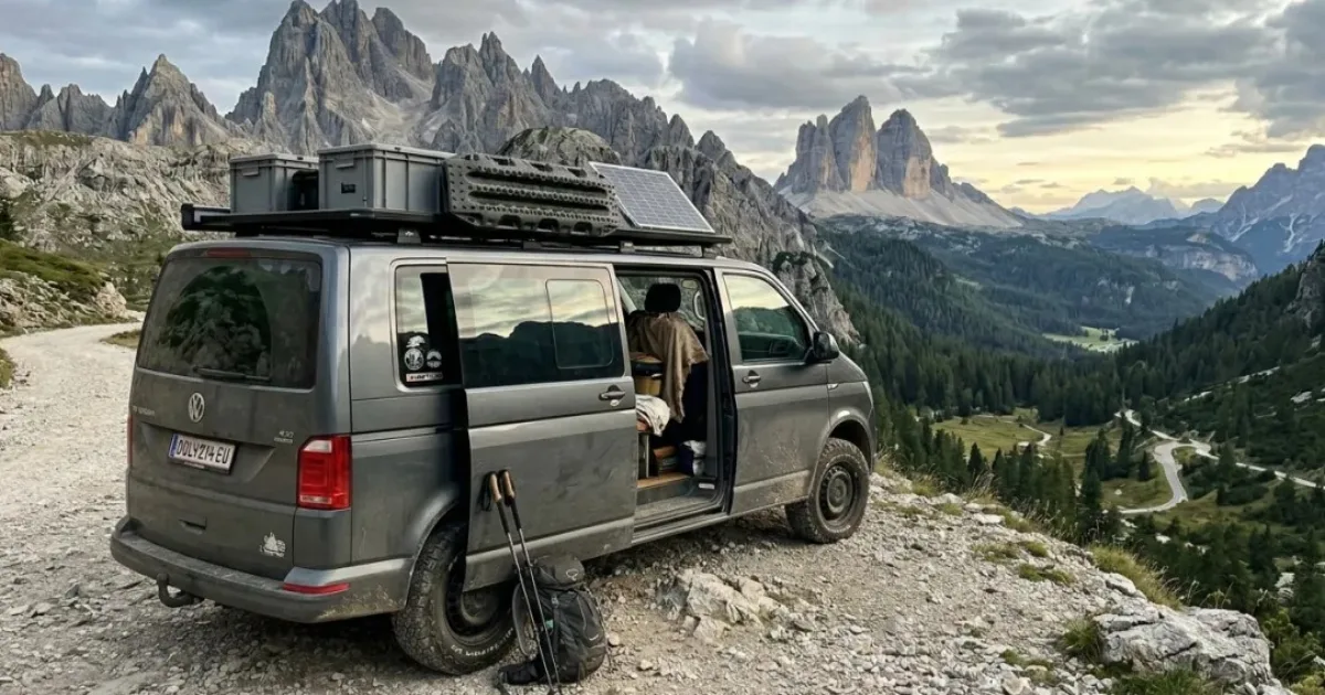
Four months in the French Alps. That was the plan — June through September, moving through the mountains at whatever pace the roads allowed.
The afternoon I nearly got stuck was a Tuesday in late July, somewhere above Barcelonnette.
I'd found a clearing at 1,950 meters — south-facing, quiet, a view worth the drive. The app had marked it accessible. I'd spent twenty minutes on Street View checking the approach: dirt track, rocks on the shoulder, nothing that looked impassable. Fine. Go.
The last 400 meters changed.
The track narrowed where the tree line ended, which Street View had shown. What Street View hadn't shown was how the ground had softened after a week of afternoon thunderstorms. The kind of ground that looks like dirt and sounds hollow when you tap it with a boot. My van weighs 3,100 kilos. The front wheels found that out before I did.
I stopped with 200 meters still to go, rear wheels on solid rock, front wheels sinking maybe two centimeters into softened earth. Two centimeters is nothing. Two centimeters is also enough to know you're having a different kind of evening than you planned.
I reversed. Slowly, door open, watching the tires. Made it back to the rock section. Parked there instead, 200 meters short of the clearing.
That evening I did what I always did. Opened Maps, found the next candidate, switched to Street View, checked it manually. Again.
Why Navigation Apps Don't Work for Vans
Google Maps routes you from A to B without knowing anything about your vehicle. For a car, that's fine. For a van with specific dimensions on alpine roads, it's a structural problem.
These are the five measurements that actually determine whether a mountain road is driveable for you — none of which any navigation app accepts as input:
| Dimension | Why it matters |
|---|---|
| Width | Mountain roads narrow without warning. If you're 2.2m wide, a road marked "passable" for a car may require reversing 400 meters to let someone through. |
| Height | Low bridges, tunnel entrances, rock overhangs. Common above treeline and in older Alpine villages. |
| Length | Dead ends are the real risk. A 5.4m van needs roughly 8 meters of clear space to complete a three-point turn. Many mountain clearings don't have it. |
| Weight | Unpaved tracks on clay or soft ground can support a 1,200kg car and not a 3,100kg van — especially after rain. The surface looks identical in both cases. |
| Ground clearance | Drainage channels cut across mountain roads, rocky track centers, embedded boulders. Low clearance means you hear it first. |
No routing tool lets you enter these values. You can avoid toll roads. You can avoid ferries. You cannot say: filter every route through a vehicle that is 2.2 meters wide, 2.9 meters tall, 5.4 meters long, and weighs 3,100 kilos.
The Workaround That Doesn't Quite Work
The standard workaround is Street View. Before committing to any unfamiliar approach road, you scroll through the last kilometer frame by frame — looking for road width, tree branches at roof height, the texture of the ground.
It works, partially. Here's where it breaks down:
The images age. Google's camera cars don't update continuously. The road you're checking may have changed — a landslide, a new gate, an overgrown hedge that wasn't there when the images were taken. You have no way of knowing how old the frames are.
It can't show ground conditions. A track that looks solid in Street View may be soft after three days of rain. Street View shows you the surface geometry. It doesn't tell you what it does when it's wet.
It only shows what was visible from the road. The narrowing that matters is often just past a bend, or at the final approach to the clearing — exactly where Street View has gaps or partial coverage.
The result: twenty minutes of checking per spot, and still an element of uncertainty you only resolve by driving there.
The Knowledge That Doesn't Transfer
By September I knew which passes above 1,800 meters I could take without checking. Not because the tools improved — because I'd driven them already. I knew which tracks held weight after rain and which didn't. That knowledge is mine now.
It doesn't exist anywhere else.
Every van lifer on their first summer in the Alps rebuilds this from scratch. The experience accumulates in people. It never becomes data anyone else can use.
Sunnyplans is building a vehicle-aware routing layer for van lifers — enter your dimensions, filter out the roads that won't work before you leave. Early access is open. Join the waitlist.